Fichier:Baikal-S1999276045323.png

Ñatanaʋ pʋnɛ pɩ-walanzɩ : Kpaɣna pɩkɩsɛlɩ 800 nɛ pɩtalɩ 563 ñɩŋgʋ. Tʋtʋ lɛɛtʋ : Kpaɣna pɩkɩsɛlɩ 320 nɛ pɩtalɩ 225 ñɩŋgʋ | Kpaɣna pɩkɩsɛlɩ 640 nɛ pɩtalɩ 450 ñɩŋgʋ | Kpaɣna pɩkɩsɛlɩ 1 024 nɛ pɩtalɩ 720 ñɩŋgʋ | Kpaɣna pɩkɩsɛlɩ 1 220 nɛ pɩtalɩ 858 ñɩŋgʋ.
Kiɖe tɛɛ takayaɣ (Kpaɣna pɩkɩsɛlɩ 1 220 nɛ pɩtalɩ 858 ñɩŋgʋ, takayaɣ walanzɩ : 1,9 Mio, MIME akɩlɩ : image/png)
| Kɛdɩtʋ |
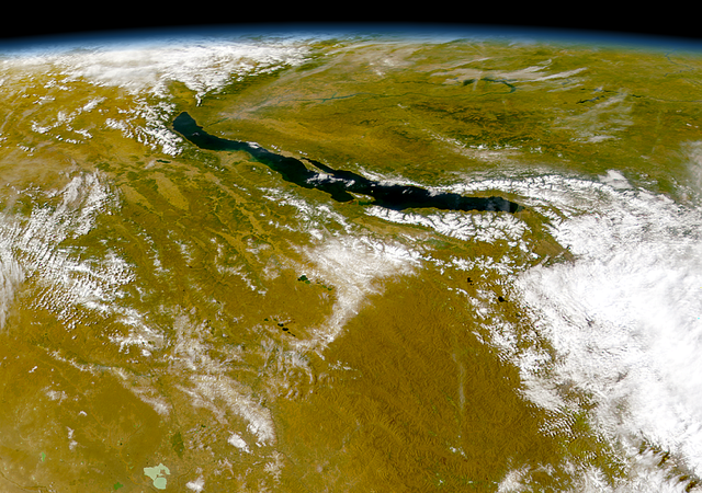
Čeština: Bajkal
|
||||
| Efemiye | |||||
| Kiɖe | http://visibleearth.nasa.gov/view_rec.php?id=1002 - http://visibleearth.nasa.gov/images/1002/S1999276045323.png | ||||
| Mayʋ | Provided by the SeaWiFS Project, NASA/Goddard Space Flight Center, and ORBIMAGE | ||||
| Waɖɛ haʋ (Ɖaɣnʋʋ labɩnaʋ takayaɣ kanɛ) |
|
Takayaɣ caanaʋ tɔm kɛdʋʋ
Tukina efemiye nɛ ñɩɣtʋ nɛ ŋna takayaɣ kanɛ ɛzɩ kaawɛʋ alɩwaatʋ ndʋ tɩ-taa yɔ.
| Efemiye nɛ ñɩɣtʋ | Tampɔɔ | Walanzɩ | Labɩnayʋ | Tɔm taa nuutuu | |
|---|---|---|---|---|---|
| lɛlɛɛyɔ | 21 Hasɩyaɖɛ fenaɣ 2005 à 03:57 | | 1 220 × 858 (1,9 Mio) | Bdk | Lake Baikal *Source: http://visibleearth.nasa.gov/view_rec.php?id=1002 - http://visibleearth.nasa.gov/images/1002/S1999276045323.png *Sensor OrbView-2/SeaWiFS *Dates: Datastart 1999-10-03 - Visualization Date 1999-10-03 *Visible Earth v1 ID 3678 *Credit: |
Takayaɣ labɩnaʋ
Takayɩhayʋʋ kɩtɩŋʋʋ lakɩna takayaɣ kanɛ tʋmɩyɛ :
takayaɣ labɩnaʋ nɛ paa anɩ
Wikinaa kɩtɩŋaa lɛlaa lakɩna kɩlɛmʋʋ kʋnɛ nɛ tʋmɩyɛ :
- Labɩnaʋ ar.wikipedia.org yɔɔ
- Labɩnaʋ arz.wikipedia.org yɔɔ
- Labɩnaʋ ast.wikipedia.org yɔɔ
- Labɩnaʋ as.wikipedia.org yɔɔ
- Labɩnaʋ az.wikipedia.org yɔɔ
- Labɩnaʋ be.wikipedia.org yɔɔ
- Labɩnaʋ ca.wikipedia.org yɔɔ
- Labɩnaʋ ce.wikipedia.org yɔɔ
- Labɩnaʋ crh.wikipedia.org yɔɔ
- Labɩnaʋ cs.wikipedia.org yɔɔ
- Labɩnaʋ cy.wikipedia.org yɔɔ
- Labɩnaʋ de.wikipedia.org yɔɔ
- Labɩnaʋ de.wikivoyage.org yɔɔ
- Labɩnaʋ de.wiktionary.org yɔɔ
- Labɩnaʋ diq.wikipedia.org yɔɔ
- Labɩnaʋ el.wikipedia.org yɔɔ
- Labɩnaʋ en.wikipedia.org yɔɔ
- Labɩnaʋ eo.wikipedia.org yɔɔ
- Labɩnaʋ es.wikipedia.org yɔɔ
- Labɩnaʋ eu.wikipedia.org yɔɔ
- Labɩnaʋ fa.wikipedia.org yɔɔ
- Labɩnaʋ fr.wikivoyage.org yɔɔ
- Labɩnaʋ ga.wikipedia.org yɔɔ
- Labɩnaʋ he.wikipedia.org yɔɔ
- Labɩnaʋ hr.wikipedia.org yɔɔ
- Labɩnaʋ hu.wikipedia.org yɔɔ
- Labɩnaʋ hy.wikipedia.org yɔɔ
- Labɩnaʋ it.wikipedia.org yɔɔ
- Labɩnaʋ ja.wikipedia.org yɔɔ
- Labɩnaʋ ka.wikipedia.org yɔɔ
- Labɩnaʋ kk.wikipedia.org yɔɔ
- Labɩnaʋ lb.wikipedia.org yɔɔ
- Labɩnaʋ lmo.wikipedia.org yɔɔ
- Labɩnaʋ lv.wikipedia.org yɔɔ
- Labɩnaʋ mhr.wikipedia.org yɔɔ
- Labɩnaʋ myv.wikipedia.org yɔɔ
- Labɩnaʋ my.wikipedia.org yɔɔ
- Labɩnaʋ mzn.wikipedia.org yɔɔ
- Labɩnaʋ nn.wikipedia.org yɔɔ
Cɔna takayaɣ labɩnaʋ tɩŋa